A Scientific “Forced Marriage” Takes on the Mysteries of the Loop Current
Decisionmakers need insights on how this powerful current shapes hurricanes, fisheries, energy supplies, and life in the Gulf of Mexico. An ambitious project to collect data and predict the current’s erratic behavior is compelling scientists to cross disciplines as well as borders.
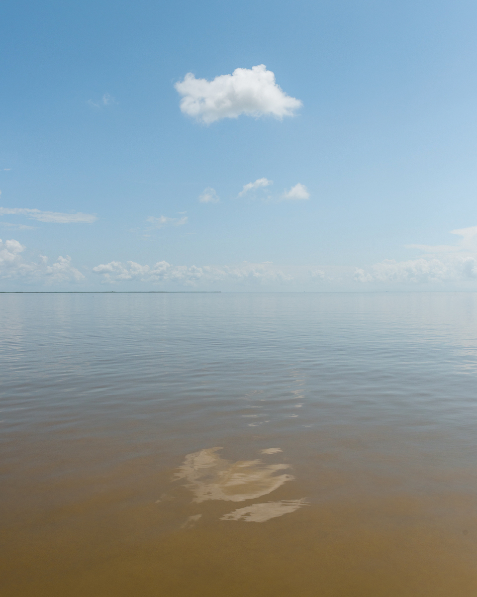
As it enters the Gulf of Mexico, the shape-shifting stream of tropical water known as the Loop Current passes between the Yucatan Peninsula to the west and Cuba to the east. When the swift current extends into the northern Gulf, its clockwise spin turns east and south to form a loop before it exits through the straits of Florida and joins the Gulf Stream. Lurking beneath its undistinguished name is a powerful and erratic force that intensifies hurricanes, disrupts oil and gas supplies, and influences fisheries in an area that provides 40% of US seafood harvests.
At times, the extended loop becomes unstable and pinches off an eddy that detaches from the current. The unfettered eddy may take months to lumber west across the Gulf. At 200 to 400 kilometers in diameter, these eddies are so formidable that, like hurricanes, they are named. In June 2010, during the massive oil spill caused by the explosion of BP’s Deepwater Horizon oil rig, a giant named “Eddy Franklin” shed off. Spill responders had worried that the Loop Current would carry the oil out of the Gulf to Cuba, the Bahamas, and the Florida Keys. But Eddy Franklin ultimately kept the oil inside the Gulf—highlighting just how little is understood about the current and its eddies.
“You don’t ass around with the loop,” retired Lieutenant General Russel Honoré told me.
“You don’t ass around with the loop,” retired Lieutenant General Russel Honoré told me. Honoré led the Defense Department’s response to Hurricane Katrina, which rapidly intensified after it gained energy from the dangerously warm 84-degree Loop Current before going on to devastate New Orleans. Anticipating when the loop will expand into the northern Gulf—and more importantly, shed an eddy—is crucial information for oil production, fisheries, flooding, shipping lanes, and search and rescue operations. Honoré said a better understanding of Loop Current norms is necessary for policymakers to prepare for active hurricane seasons, especially as the climate changes. “Loop [Current dynamics] should be part of any risk assessment,” he said. But so far the Loop Current’s behavior has proved devilishly difficult to predict.
A uniquely chaotic system
The Gulf of Mexico is a semi-enclosed mini-ocean; it holds numerous distinct water masses that combine with freshwater flowing in from rivers, all superimposed over submarine mountains and shelves. These dynamic features create a uniquely chaotic system. On average, the Loop Current sheds an eddy once every nine months, but that statistic is deceptive. Some years have none; other years have many. The trickiness of predicting Loop Current behavior was clear even when the first scientific paper on it was published in 1972.
In 2018, a disparate group of international researchers began the task of identifying new observations to improve Loop Current prediction. Now in its third and final phase, three teams of scientists involved in the Understanding Gulf Ocean Systems (UGOS) Initiative are installing subsurface monitoring equipment and preparing to launch dozens of floats, underwater drones, and advanced sensing equipment to surveil the loop’s surface currents in real time for the 2025 hurricane season.
The project is unique in that the real-time measures require coordination across US, Mexican, and Cuban waters. It is also an outlier because it is funded by the National Academies of Sciences, Engineering, and Medicine (NASEM), which is not primarily a grantmaking body; its power is in convening top scientists to tackle big problems. However, in 2013, $500 million in criminal settlement money from the 2010 BP oil spill was funneled to NASEM to start the Gulf Research Program.
The goal of the UGOS initiative is to extend accurate Loop Current predictions from days to months, explained Michael Feldman, senior program manager at NASEM’s Gulf Research Program. Timely predictions could boost safety for oil and gas work, marine traffic, and search and rescue operations in the Gulf, while also improving forecasts of hurricanes, fisheries productivity, climate change-induced coastal flooding, and sea level rise. Longer range Loop Current predictions are also crucial for anticipating two other phenomena that affect the Gulf’s economy as well as its ecosystems: the extent of the annual Dead Zone, a roughly 5,000-square mile expanse of oxygen-free water resulting from excessive nutrients, and the movements of Sargassum seaweed, extensive mats that form in the Atlantic and move toward shore.
Timely predictions could boost safety for oil and gas work, marine traffic, and search and rescue operations in the Gulf, while also improving forecasts of hurricanes, fisheries productivity, climate change-induced coastal flooding, and sea level rise.
Predicting such complex processes is never an easy task, but the UGOS project has had to navigate an unusual set of tensions—including an unanticipated collaboration of cross-disciplinary rivals, a remit to get research outputs applied to agencies’ operations, and the risk that the capricious Loop Current will go quiet as soon as all the expertise and equipment have been assembled to measure it.
Already, the clock is ticking toward the study’s end in 2027, noted Francis Wiese, who as chair of the UGOS standing committee is charged with guiding the effort. “If this information is to be meaningful for resilience and the safety of people in the Gulf, it has to move from research to operations,” he told me. As I followed the team this fall, it became clear that science as usual would not automatically yield improved forecasts—and that the uncharted waters of “transition to operations” can run counter to traditional academic research.
Creating a “forced marriage” among researchers
Until recently, the puzzling behavior of the Loop Current was largely a concern of oil and gas companies. During one unusually active period, between July 2014 and July 2015, the Loop Current shed five eddies into the Gulf, which disrupted work on Chevron’s Big Foot oil installation for months, costing the company at least $1 billion. Eddies can also shut down production entirely, damage equipment, and potentially exacerbate oil spills.
At its creation in 2013, NASEM’s Gulf Research Program was tasked with investing in three decades of research to improve oil system safety, human health, and environmental resources in the Gulf of Mexico and the US outer continental shelf. Predicting the Loop Current quickly emerged as a priority, and in 2017 a consensus committee on Advancing Understanding of Gulf of Mexico Loop Current Dynamics was convened. Its 2018 report identified knowledge gaps and called for an international campaign of complementary research, observation, and analysis to build an observing system for the Loop Current, at a cost of about $120 million. Ultimately, the current plan is a smaller-scale version of the original and focuses on collecting the most critical data at roughly one-third that cost.
“With limited resources, we have to be strategic where and when we make observations,” said Ruoying He, a physical oceanographer at North Carolina State University who has spent more than 20 years modeling oceans and is a coauthor of the consensus report. Still, He said the researchers are enthusiastic the project will achieve its goal. He will assimilate the resulting data into a regional ocean model to be used by the National Oceanic and Atmospheric Administration (NOAA). Together with colleagues, He has already spent considerable effort analyzing simulated data to identify what types of observations have the most potential to improve Loop Current models, notably to predict how eddies are shed.
Today, a large swath of ocean observations come from satellites, which unfortunately can have low resolution or be hampered by cloud cover. Although a network of 1,600 sensors, operated by a collection of academic and government entities called the Gulf of Mexico Coastal Ocean Observing System, has provided real-time measurements of temperature, salinity, wind, and current speed since 2005, those efforts are concentrated in the northern Gulf. To observe and model the Loop Current, researchers must look to the southern Gulf and then strategically choose which elements to monitor there.
To help, oil and gas companies have shared at least $20 million of proprietary data collected by ships crossing Loop Current fronts since the early 2000s. “That’s a pretty special thing,” explained Feldman. “For a very long time, industry wouldn’t share any of this, but there was enough belief in what we’re doing that they are willing to share with UGOS.”
Data from existing sensors, including those from Mexico as well as industry, led UGOS researchers to conclude that understanding two particular regional features would be essential to improve predictions. The first is understanding how warm water flows through the Yucatan strait into the Gulf. The second is understanding the current’s subsurface structure—both the density and the velocity of the water below the Loop Current. Understanding these two features could help researchers model how eddies on the surface interact with those thousands of feet below to shape the current—while also influencing the way the current sheds and reabsorbs eddies.
In 2022, the Gulf Research Program solicited proposals for a five-year effort to improve Loop Current forecasts to support offshore energy safety, fisheries’ resilience, and hurricane safety. “We hoped to get proposals from integrated teams that combined modeling, observations, and application,” said Wiese. When that didn’t happen, UGOS leaders selected proposals from three separate groups: a real-time observational system team, led by Amy Bower of the Woods Hole Oceanographic Institution; an adaptive surface current sampling team, overseen by Steven DiMarco at Texas A&M University; and a modeling team, helmed by Eric Chassignet at Florida State University.
As I followed the team this fall, it became clear that science as usual would not automatically yield improved forecasts—and that the uncharted waters of “transition to operations” can run counter to traditional academic research.
After the awards were made, however, Feldman informed the teams they would be required to work closely together to accomplish the overarching goal. All of the team leads were caught off guard. “This was a forced marriage among competitors,” Ruoying He told me. “It’s not something everyone was happy about, but looking at the big picture, it was a necessary action to take.”
To achieve the scientific goal, the combined group knew it needed to integrate observationalists and modelers. To make something useful to agencies and industry players, they would also have to include members of those organizations. Having seen other projects fail to transition their output into practice, UGOS members included researchers from, for example, NOAA and the US Navy. “We set up the [first in-person] meeting to drive ‘transition to operations’ from the get-go,” said Wiese.
Observers and modelers unite to find the “white whale”
Learning to work together has been a time-consuming process. For two months in 2022, Bower, DiMarco, and Chassignet met twice weekly to hammer out a structure involving six working groups. At the most recent UGOS meeting, in Tallahassee, Florida, in October, the consortium decided on another, less radical, reorganization of teams and goals as they continue to refine their processes and prepare to place equipment into the Gulf.
The ambition and scale of the project were clear in Tallahassee as Bower gave a status update to the roughly 50 people present who make up the three teams. With her guide dog, Intrepid, looking on, Bower, who is legally blind, detailed the vast array of instruments being deployed to fulfill the project’s mission. First, the addition of 35 UGOS-funded floats in the southern Gulf will expand coverage of temperature and salinity already gathered by existing floats, which are funded by NOAA. As a result, she explained, the Gulf of Mexico currently has the “highest density of floats in the world.” Five pressure-equipped inverted echo sounders (PIES) are stationed in the Yucatan Channel to monitor deep ocean currents. Additional PIES that also measure current will be installed in an array with other current profilers on the northern Gulf’s continental slope next year, which Bowers said will “serve as an antenna,” detecting energy transfers deep in the water column. Beyond that, high-frequency (HF) radar installed in the Yucatan Channel will provide near real-time measures of the speed and direction of surface currents.
Then DiMarco’s adaptive sampling team from Texas A&M described how they will deploy observational equipment in the Yucatan Channel—including gliders, floats, and most notably airplanes equipped with a Remote Ocean Current Imaging System (ROCIS) to get high-resolution data of sea surfaces, ideally during key moments of the Loop Current extension and eddy shedding.
The ROCIS system was originally built for the Department of Defense and was declassified for commercial use in 2016. “This project will be the first time ROCIS is used for science,” explained Jan van Smirren, UGOS technical coordinator and consultant with Ocean Sierra, LLC, a private company that provides the oil and gas industry with oceanographic and meteorological insights.
“Deciding how to adaptively sample the Gulf of Mexico really depends on what stage the loop is at,” explained Ruoying He. “It will require timely two-way communication between observers who are running the surveys and modelers who are assimilating real-time observations and making model forecasts of the Loop Current.” But the whole team is aware that the success of the project hinges on figuring out how to strategically coordinate the observers and modelers to conduct adaptive sampling.
In mid-January 2024, if all goes well, the team is scheduled to conduct a series of adaptive sampling tests to determine how best to coordinate ROCIS, underwater gliders, and other measures across the Gulf. The team has learned “how challenging a multi-instrument, multi-institution, multination coordinated field effort actually is,” noted Feldman. Four autonomous gliders—two from the Centro de Investigación Científica y de Educación Superior de Ensenada(CICESE) in Mexico and one each from Texas A&M and Rutgers University—will be released into the Yucatan strait, where the warm waters first rush into the Gulf from the Caribbean. The gliders will spend 45 to 60 days zigzagging across the strait, depending on their battery life.
“This was a forced marriage among competitors,” Ruoying He told me. “It’s not something everyone was happy about, but looking at the big picture, it was a necessary action to take.”
While the gliders are unmanned, navigating their deployments remotely in this complex submarine bathymetry is tricky, Enric Pallas of CICESE explained at the Tallahassee meeting. The gliders ascend and descend through the region’s submarine mountain range to collect current, salinity, and temperature data while contending with a strong secondary northward current and a great deal of marine traffic. “It can be quite scary for the pilots to fly a glider in this scenario and avoid the thousands of boats in the Yucatan area,” said Pallas.
In July 2023, researchers lost contact with a launched glider after 10 days due to what they now believe was a surface crash with a boat. It was ultimately recovered—in two parts. It appeared that someone, possibly a fisherman, had opened it and thrown it on the beach.
Equipment failures and subsurface terrain are simpler to navigate than political boundaries. Because the Loop Current crosses multiple borders, the gliders need to operate in three different exclusive zones: Mexico, Cuba, and the United States. It took nearly a year to get the necessary permissions. “It is not the Gulf of the United States, it’s the Gulf of Mexico,” observed DiMarco. “International collaborations here are just crucial.”
All of these novel data—built up from disparate teams—are necessary to unearth key predictive metrics, Bower told me before the Florida meeting. When I asked her what UGOS’s “white whale” is, she said, “a more comprehensive understanding of the interaction between the lower and upper layers of the Gulf of Mexico.” Teasing apart this interplay requires extraordinary collaboration between researchers who normally work independently. She observed, “In my experience, this closeness of relationships between such large groups of observationalists and modelers is unusual—and it’s hard.”
Watching the current in real time
New technologies and sampling regimes are already offering researchers an unprecedented ability to see what the current is doing. It had long been theorized that the Loop Current might reverse from time to time, but until recently that had never been observed. During 2022’s Hurricane Ian, DiMarco’s team documented a short-term reversal of the Loop Current flow west of Cuba due to wind. Where the winds were strong, the surface layers of the Loop Current arrested and reversed. Although it is unclear whether the flow reversals are indicative of more significant changes to the current, this observation demonstrates that it is now possible to document what is happening in the Gulf in real time.
During the 2023 hurricane season, the project gave other exciting glimpses of insights to come. On August 26, Hurricane Idalia began to form as a tropical depression in the Caribbean. On the HF radar, Scott Glenn, a Rutgers University researcher and member of the adaptive sampling team, watched as it turned into a tropical storm. Unfortunately, communications went down, and the team feared data collection had stopped. About three days later, communications came back up, and all the data filled in, giving a picture of how Idalia rapidly intensified from Category 1 to Category 4 as it passed over the Loop Current near western Cuba before making landfall on August 30. “We have three stories here,” Glenn explained. First, HF radar identified the storm formation in the Yucatan. Then, the floats documented the storm interaction with the Loop Current. Finally, the gliders recorded the conditions during the rapid intensification in shallow water.
UGOS’s critical data-gathering push—dubbed the Grand Adaptive Sampling Experiment (GrASE)—is expected to begin in 2025. GrASE will require observers and modelers to communicate weekly to determine when ROCIS flights should take off or when gliders, floats, or drifters should be deployed. GrASE’s success will hinge on how well the teams sustain what will be months-long collaboration. The lead for the GrASE project is Steve Morey, oceanographer at Florida Agricultural and Mechanical University, who told me that the overarching goal is to capture upstream data as waters enter the Yucatan Channel from the south, once the Loop Current is already extended enough to shed an eddy.
Timing will be key. Model forecasts are very sensitive to the initial conditions of the ocean, and some features are undersampled—notably, the small frontal cyclones that develop around the Loop Current and introduce instabilities that grow over time and influence whether eddies separate. As a result, forecast models are lousy at predicting whether and when the Loop Current will shed eddies after it extends out.
One enormous challenge is getting data on all the different types of eddies that influence the Loop Current’s behavior. “Eddy shedding events are driven by Loop Current instability; many variables interact nonlinearly,” explained Luna Hiron, a postdoctoral researcher on the modeling team at Florida State University. Hiron’s PhD research demonstrated how small frontal counterclockwise eddies near the boundary of the Loop Current can shape how it meanders. Simultaneously, there are also deep eddies roughly 3,000 meters below the surface that can influence when Loop Current eddies on the surface separate. And, if this isn’t confusing enough, Loop Current eddies can detach and reattach mutiple times.
The whole team is aware that the success of the project hinges on figuring out how to strategically coordinate the observers and modelers to conduct adaptive sampling.
To enhance predictability of the Loop Current’s behavior in both the short and long term, Hiron said the team analyzed how well the models perform. Presently, she explained, satellites provide reasonable data on larger surface counterclockwise eddies found on the northern and eastern sides of the Loop Current, but that’s not the case for the smaller, more dynamic eddies on the western side. “We don’t see them at all on satellites,” Hiron said. The smaller eddies can introduce instabilities that grow over time and influence when eddies separate. New data from HF radar or information from the ROCIS flyovers may offer insights that can assist in making predictions.
HF radar is also able to measure the position of the current in the Yucatan Channel. The water moving through the Yucatan Channel seems to prefer flowing east or west of a submerged bank called Banco Arrowsmith, but not directly over it, DiMarco told me. And that east-west wobble has downstream impacts. Mexican mooring data, published in 2023 by CICESE’s Julio Sheinbaum and colleagues, demonstrated that shifts in the position of the Loop Current as it enters the Yucatan Channel can determine whether the current extends north into the Gulf or retracts. The findings suggest that eddies only get shed when the Loop Current extends more than 1,800 kilometers from the Yucatan Channel.
“Understanding the flow out of Yucatan is critical,” agreed Tim Gallaudet, an oceanographer who is a retired rear admiral in the US Navy. “Any model is dependent on reducing uncertainty in the initial environmental conditions. Everything upstream matters,” he said.
In the middle of all these meticulous preparations flows another anxiety: What if the Loop Current doesn’t extend or shed eddies during the couple of years the project has left? UGOS teams have spent over a year coordinating the movement of equipment and securing permits to deploy equipment in the Mexican Caribbean—all the time knowing that the Loop Current may not cooperate. Ruoying He said these worries are well founded: “It’s happened before in another research program. We planned a comprehensive campaign, but nature didn’t give the variability we’re trying to measure.”
Turning knowledge into predictive insights
Although there is little doubt that UGOS will offer an unprecedented characterization of the Loop Current, the project is ultimately meant to improve the data that feed disparate models. It is not as simple as producing a standalone model that industry or federal agencies could easily plug into existing operations. Improving multiple models, therefore, will be an iterative process of data assimilation unique to each application and agency.
Researchers have been keenly aware of this gap from the beginning. “Research-to-operations transitions have been and remain one of the biggest challenges in all scientific research,” explained Feldman. Scientists, Hiron noted, have a tendency to try to understand the whole system, whereas UGOS is focused on more specific goals: to improve the operational forecasts of the Loop Current system, so the outcomes provide what governments and companies need to make practical decisions. “If we achieve what the stakeholders want, then that’s going to make the transition into operational use much more effective,” she said.
The oil and gas industry, which needs a significantly better system for forecasting Loop Current behavior, has identified a metric to help its operations in the short term. Jim Stear, senior principal offshore engineer at Chevron, explained that when currents are above 1.5 knots, oil and gas operations need to shut down because oscillations in floating platforms can weaken the mooring system. Today, there are 57 permanent deepwater structures in the Gulf, which may soon be joined by offshore wind platforms. Satellite imagery and models are able to deliver, at best, a few-day forecast of the Loop Current. Getting UGOS to deliver the position of the 1.5 knot line along the boundary of the current would be a good first step toward anticipating the loop’s behavior because knowledge of the line’s position would help workers determine when to shut down operations before faster waters arrive.
The energy industry will likely be the speediest to turn UGOS’s data into predictions because it has a strong economic incentive. Still, Stear is not expecting that papers and codes from UGOS will be taken up within months to produce an operating, dependable system. “I think that transition period is probably going to be several years,” he said.
It had long been theorized that the Loop Current might reverse from time to time, but until recently that had never been observed. During 2022’s Hurricane Ian, DiMarco’s team documented a short-term reversal of the Loop Current flow west of Cuba due to wind.
The way forward to assist the National Weather Service’s hurricane prediction, NOAA’s fisheries, and the Coast Guard is less straightforward. Hurricane prediction, for example, makes use of a dozen disparate models. Although UGOS findings have the potential to be integrated on different timescales into this alphabet soup of models—named HYCOM, ROMs, and MOM6—each of these models and the stakeholders that incorporate them into their various forecasts work on different time horizons.
Matthieu Le Henaff, a hurricane modeler at the University of Miami, is a stakeholder who is exploring how to incorporate UGOS data into NOAA models. According to Le Henaff, data from gliders, floats, and PIES will be assimilated into the MOM6 model, the ocean component of global climate and earth system models, which will ultimately feed into the Hurricane and Forecast System model. But the MOM6 ocean model won’t be operational for at least a couple of years, he noted. In particular, he anticipates that glider data will better characterize how the Mississippi freshwater river plume spreads on the ocean surface, resulting in a large density gradient that can favor hurricane intensification—and is currently something tricky for models to represent. However, assimilating data from ROCIS and HF radar will require more work.
Fisheries biologists work on even longer timescales. “We tend to update our stock assessment models, and therefore catch advice, to fisheries managers every five to seven years,” said Mandy Karnauskas, a fisheries biologist at NOAA’s Southeast Fisheries Science Center in Miami. Catch limits, for example, are based on historical population dynamics, response to fishing pressure, and estimates of recruitment of new fish into the population, which can be highly influenced by large-scale ocean dynamics such as the Loop Current. “When the Loop Current is extended to the north, it acts as a barrier to transport from the shelf to offshore—which favors recruitment. UGOS will investigate Loop Current influence on recruitment of red snapper, arguably the most important commercial fish in the Gulf of Mexico,” said Ana Vaz, a fisheries modeler at the University of Miami who works with Karnauskas. On the other hand, the Loop Current might influence environmental conditions that indirectly shape species distributions. For example, the greater amberjack lives around Sargassum seaweed during its early pelagic years, and when the Loop Current brings the seaweed rafts into the Gulf it changes their population dynamics.
Several of the researchers I spoke with were concerned that, without defined transition pathways and metrics, UGOS’s diffuse insights risk not being operationalized, even though UGOS members are working with representatives of federal agencies like Le Henaff, Karnauskas, and Vaz. And there is a range of opinions regarding the UGOS team’s responsibility to transition to operations. “We are a scientific community,” Chassignet, lead of the UGOS modeling team, told me. “The best thing for us to do is science.” If the science is good, he reasoned, it will get taken up into models. With almost 300 scientific publications and over 13,000 citations, Chassignet exemplifies a perspective rooted firmly in academia.
However, several other UGOS members, notably Glenn and van Smirren, think UGOS needs to actively engage stakeholders to ensure these new insights and capabilities are taken up by agencies—or they could have trouble justifying the millions spent. “We can’t just say we improved the Loop Current forecast by some percentage and then we left the room,” said Glenn. “I want this work to have an impact by saving lives and improving the economy.”
Perhaps proving the point that getting new insights incorporated into long-standing models requires a hands-on approach, Ruoying He is certain that the model he oversees will readily accept UGOS outputs: “I know for sure the ROMS [regional ocean modeling system] is intended to be adopted by NOAA by the end of the project.” As the person coleading that charge, he said, “It will be an operational forecast system for the ocean circulation of the Loop Current in the Gulf of Mexico and beyond.”
Hard-won results
After 18 sometimes bumpy months, Amy Bower reflects that the project’s level of integration has come at a cost. Battling meeting fatigue and more work than UGOS leadership may have anticipated, she said it’s been an iterative process of reevaluating goals, metrics, and output. “I see the original consortia falling more into the history books, to have almost disappeared now,” she explained.
Scientists have a tendency to try to understand the whole system, whereas UGOS is focused on more specific goals: to improve the operational forecasts of the Loop Current system, so the outcomes provide what governments and companies need to make practical decisions.
“It’s not a common approach because it is very complicated and costly,” agreed Le Henaff, but he’s convinced this level of coordination will lead to practical insights. For example, when the teams are in the same room, they are able to navigate how everyone’s biases impact the goals. “We will learn things we would not be able to learn if people were doing things on their own without consulting each other,” he said.
While the forced marriage of competitors was a gamble, NASEM’s Feldman stands by the decision. “Forcing this collaboration was without a doubt the right thing to do,” he said. “[Loop Current prediction] had been a problem unsolved for so long, and we had the opportunity, resources, and attention of people to take our best shot at trying to solve it.” In hindsight, he might have crafted the call for proposals such that the teams would organize themselves. He estimates the need to restructure and rethink how each project would run probably caused six to nine months of delay. Nevertheless, “I would still do it again,” he affirmed. “Everyone has put ego aside to work together,” he said. “And that is a really rare thing.”
The UGOS program still has years to go, but the hard-won cooperation between the teams may account for its legacy and ultimate success. In Ruoying He’s view, one of the most important outcomes of UGOS has been creating a strong partnership between observers and modelers—while overcoming the challenges of sustained science operations and their adoption by agency and industry partners. “This is what makes UGOS transformative—making it operational to deliver outputs to stakeholders,” he told me. “Otherwise, it will just be a new set of scientific papers that will be produced from the program. We’ve been doing that for the last 50 years.”