Ground Truth: Corona Landmarks
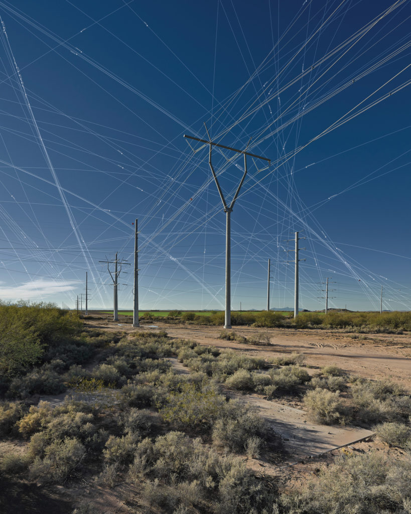
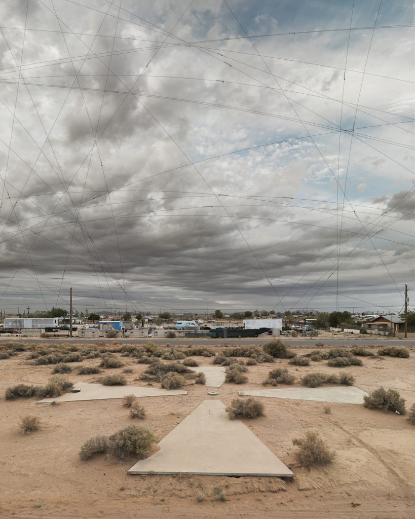
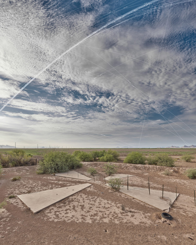
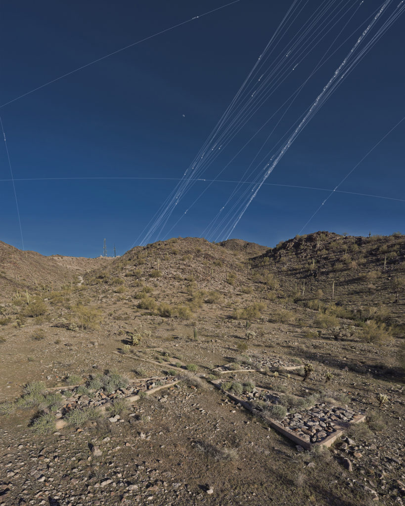
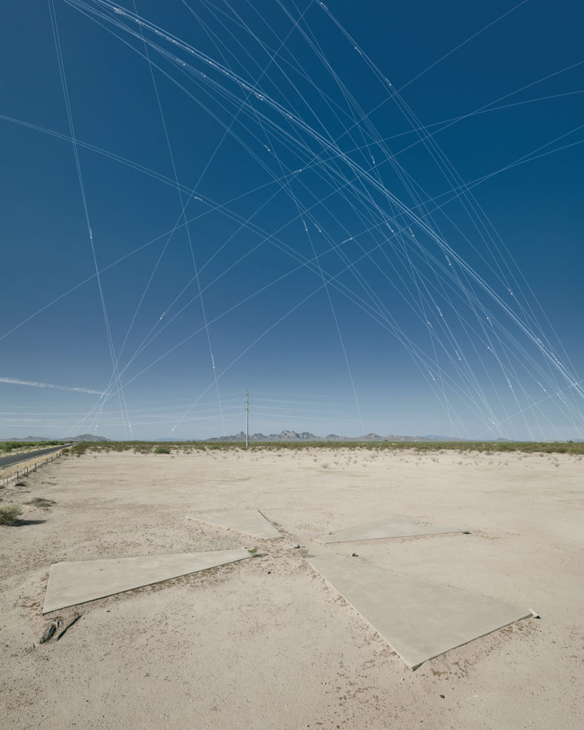
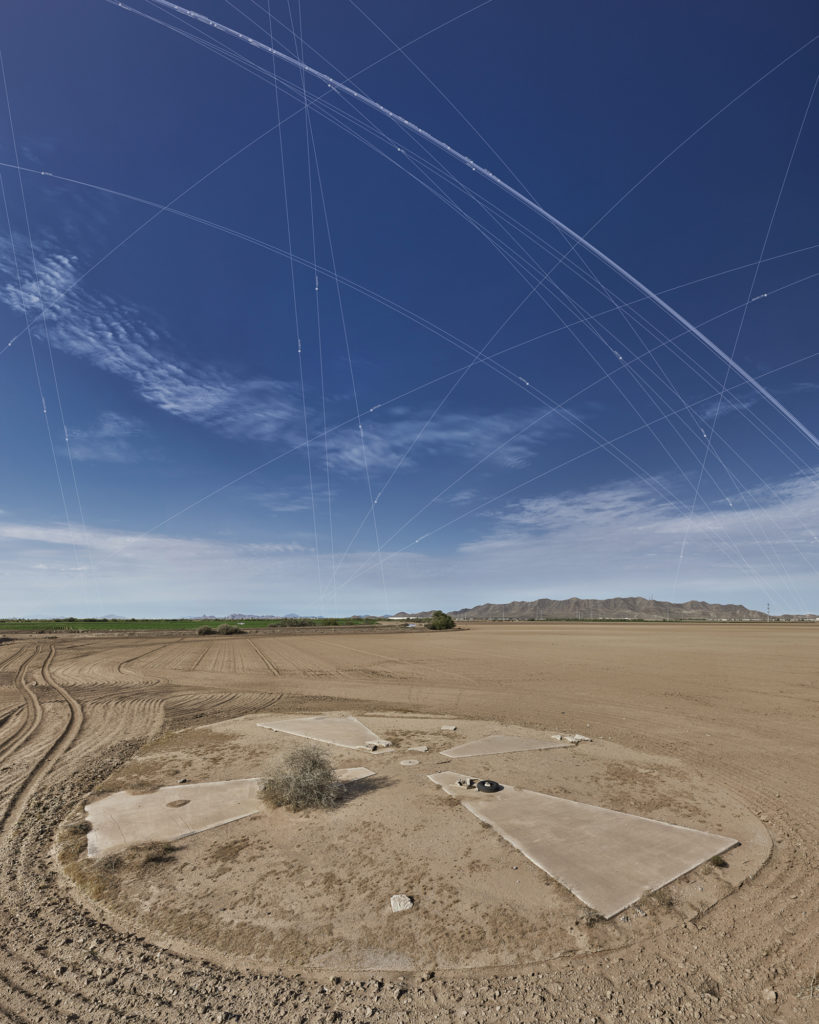
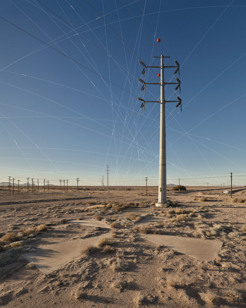
In this series of images of what remains of the Corona project, Julie Anand and Damon Sauer investigate our relationship to the vast networks of information that encircle the globe. The Corona project was a CIA and US Air Force surveillance initiative that began in 1959 and ended in 1972. It involved using cameras on satellites to take aerial photographs of the Soviet Union and China. The cameras were calibrated with concrete targets on the ground that are 60 feet in diameter, which provided a reference for scale and ensured images were infocus.
Approximately 273 of these concrete targets were placed on a 16-square-mile grid in the Arizona desert, spaced a mile apart. Long after Corona’s end and its declassification in 1995, around 180 remain, and Anand and Sauer have spent three years photographing them as part of an ongoing project. In their images, each concrete target is overpowered by an expansive sky, onto which the artists map the paths of orbiting satellites that were present at the moment the photograph was taken. For Anand and Sauer, “these markers of space have become markers of time, representing a poignant moment in geopolitical and technologic social history.”
Anand and Sauer are artists and educators based in Phoenix. Anandis currently associate professor in the School of Art at Arizona State University and Sauer serves as an assistant professor at the Art Institute of Pittsburgh—Online Division. Both received their MFA degrees in Photography from the University of New Mexico and began collaborating in 2005. Visit their website at http://www.2circles.org/.
An exhibition of this series is on view at the National Academy of Sciences, 2101 Constitution Ave. NW, Washington, DC, from September 24, 2018, through February 22, 2019.

