An Elusive and Indefinable Boundary
Seven years before the release of Silent Spring in 1962, marine biologist and writer Rachel Carson wrote The Edge of the Sea. Part field guide to the Atlantic seashore, part meditation on Carson’s love for the evanescent world between land and water, it was an idea that came to her while working for the United States Fish and Wildlife Service. The book begins:
The edge of the sea is a strange and beautiful place. All through the long history of Earth it has been an area of unrest where waves have broken heavily against the land, where the tides have pressed forward over the continents, receded, and then returned. For no two successive days is the shore line precisely the same.… Today a little more land may belong to the sea, tomorrow a little less. Always the edge of the sea remains an elusive and indefinable boundary.
As a photographer, my work explores that indefinable boundary, often by visiting sites multiple times over the course of many years. I photograph certain structures repeatedly to capture a perspective of change and time that’s larger than the frame itself.
I photograph certain structures repeatedly to capture a perspective of change and time that’s larger than the frame itself.
The development of the American shoreline reflects our ideas of living with the natural world—a world which, it was once believed, could be manipulated and maneuvered without consequence. The Army Corps of Engineers, the agency responsible for designing and implementing the infrastructure of many of these water-ruled landscapes, describes their mission as relating to “the desire of many people to live near the coast,” which, along with economic opportunities, “led to extensive development of coastal areas and the need to protect lives and property from waves, storms, and erosion.”

In South Louisiana, where much of my work has been based over the past 10 years, the control of water permeates all aspects of life. In geological terms, floods formed Louisiana as snowmelt from as far west as the Rocky Mountains drained into the Mississippi River. When the development of the Mississippi Valley accelerated in the early 1900s, people sought ways to lock the river in place. The Flood Control Acts of 1928 and 1936 authorized the Army Corps to construct thousands of miles of levees—structures that were monumental in shaping the Louisiana landscape and would have massive environmental impacts in the decades to come.
Since the 1930s, approximately 2,000 square miles of the state’s coast have sunk into the Gulf of Mexico. A plethora of maps and aerial surveys document this figure in attempts to convey the magnitude of what has already been lost to the sea.

A particular visual lexicon has emerged out of the desire to understand a “disaster” at this scale, one that seeks to make the complexity of changing landscapes legible in a compact form. The violence of climate change is often represented and communicated through images of flooding, destroyed buildings, and wildfires. But these events are seen through a narrow temporal lens that omits the many social, political, economic, and scientific reasons for the way disasters unfold.
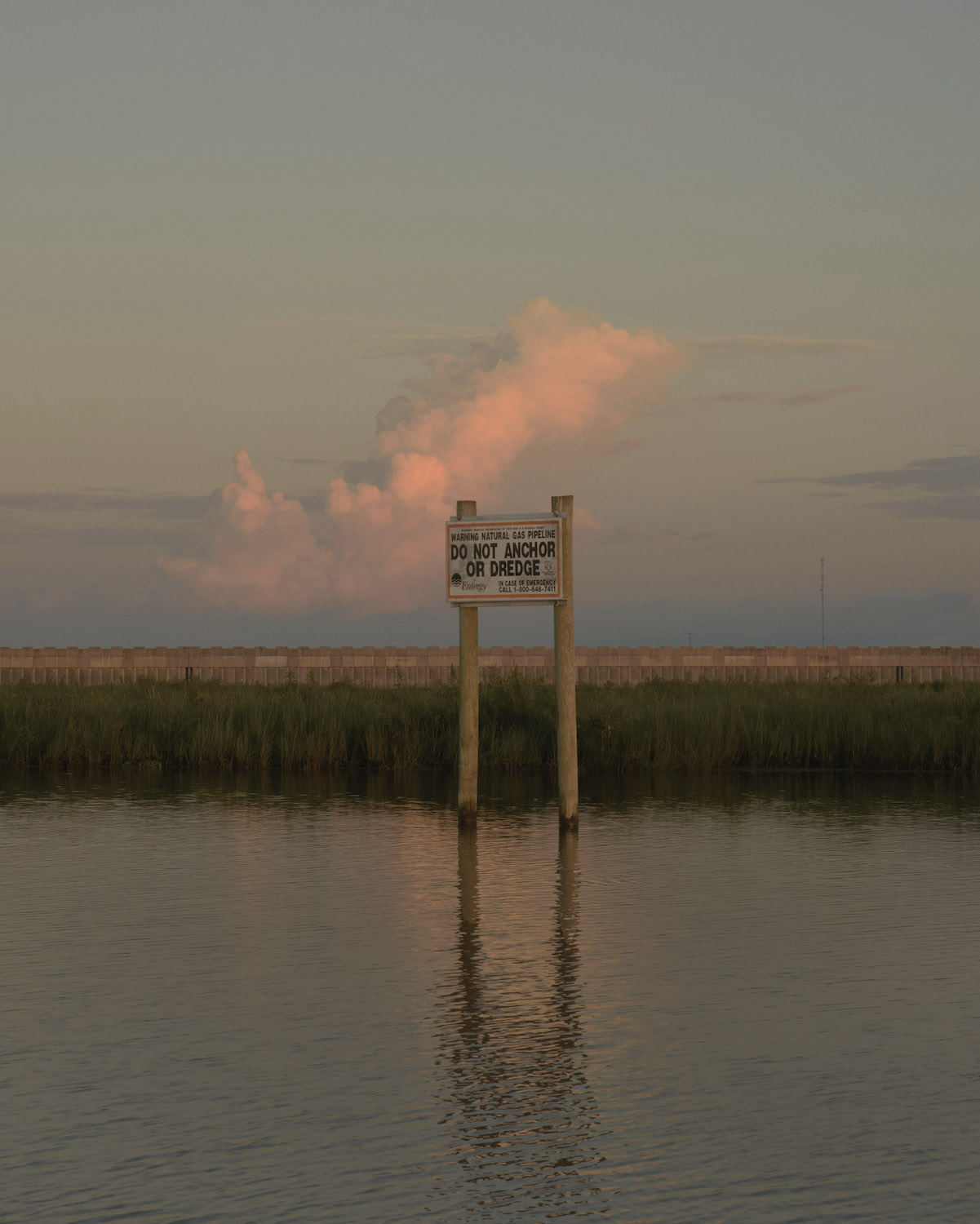
In my work, I engage with the ongoing environmental crisis by looking at the ways architecture and infrastructure symbolize our beliefs about inhabiting space. I’m drawn to projects like the Lake Borgne Surge Barrier, which is nicknamed the “Great Wall of Louisiana” and is the largest design-build project in the history of the Army Corps of Engineers. It is a physical monument of our relationship with the natural world.
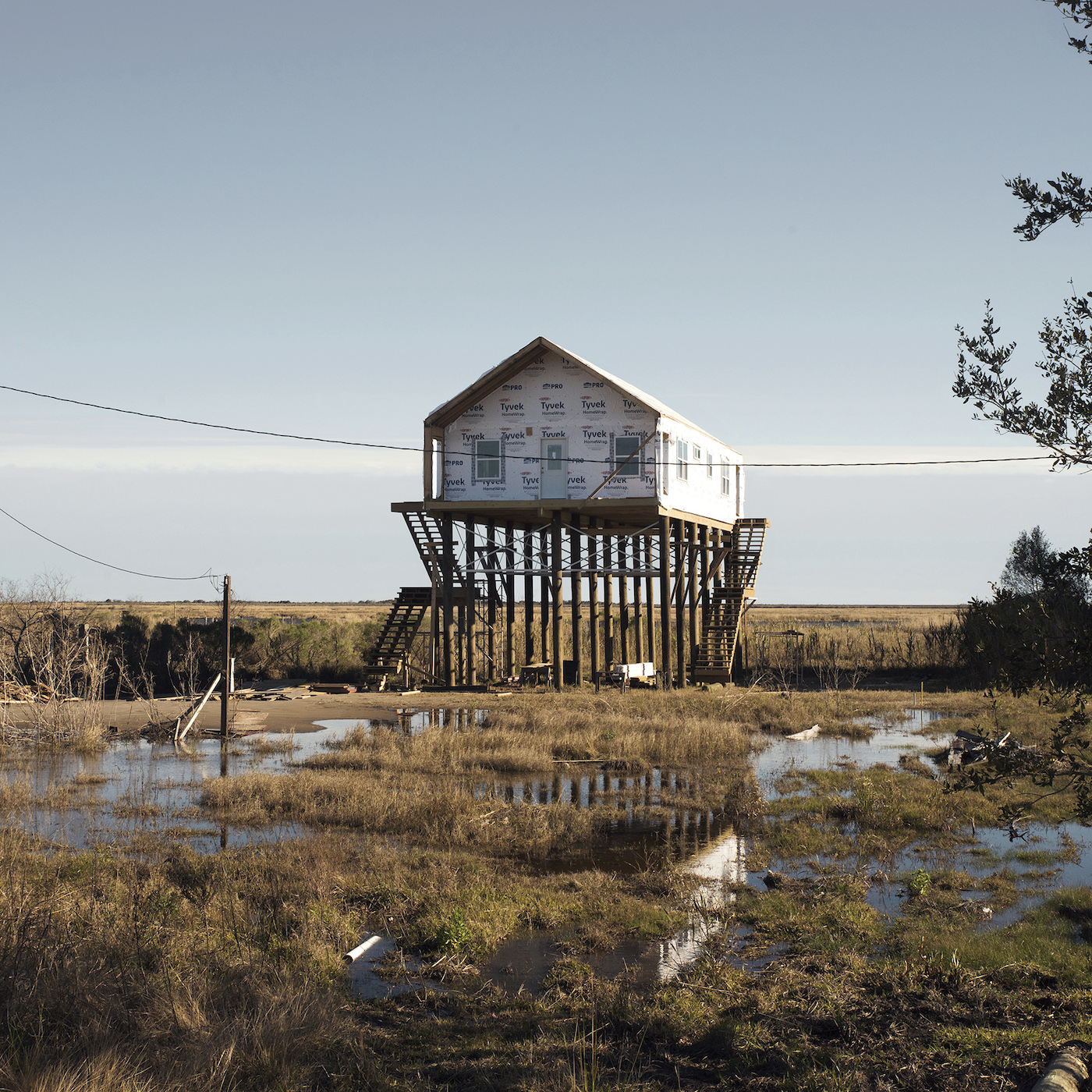

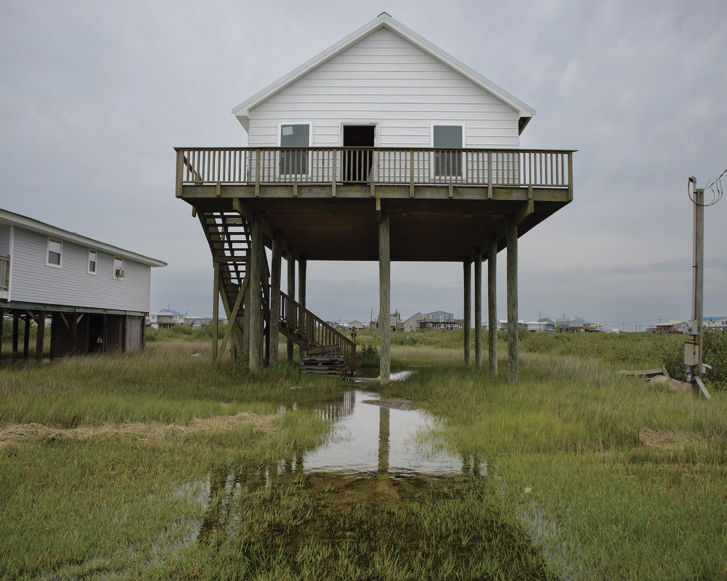
I’m also drawn to invisible infrastructures—like flood insurance—that continue to alter the landscape and built environment. Beginning in the 1960s, the National Flood Insurance Program further encouraged and incentivized the development of floodplains, and the downstream effects of these policies are now clear—for example, the flooding in Houston after Hurricane Harvey. Flood insurance also dictates the elevation of structures throughout South Louisiana, which is why so many houses are raised 12–20 feet in the air.
These subtle changes in the built environment speak to how we view our relationship to the earth and with each other. The boundaries always seem to be shifting, and yet they also stay the same. Although our tools and strategies for building have become more complex, we still all need shelter, security, water, and community.