Out of Site: Survey Science and the Hidden West
This exhibition explores the origins and expansion of visual imaging technologies within the Western landscape, aiming to delve into our fundamental fascination with what we cannot see. It covers everything from geologic processes churning over time to large-scale industrial interventions, military testing sites, and a growing network of surveillance and remote sensory technologies that can both reveal and conceal.
Out of Site examines three technological revolutions in visual imaging: wet-plate photography, used to understand and explain geological processes; aerial photography and pattern recognition; and the increasing use of drones, satellites, and other long-range photographic technologies to image secretive sites, military installations, map environmental change, and monitor our movements. This exhibition revisits and revises our understanding of visual technologies as applied to remote Western lands—places that are both within and without modern society, deeply entwined with our daily lives yet often imperceptible or undetected.
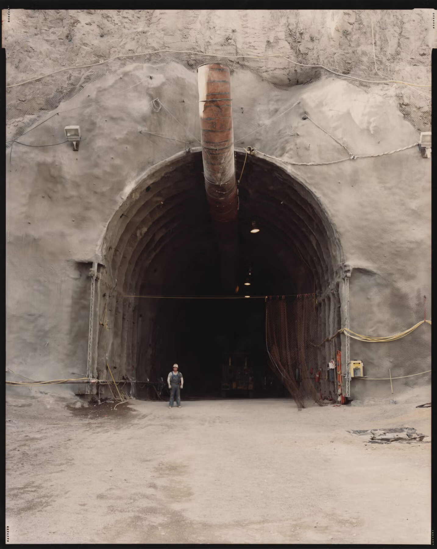
On view at the Autry Museum of the American West in Los Angeles from May 18, 2024, to January 5, 2025, the exhibition is part of the Getty Foundation’s PST ART: Art & Science Collide initiative. Out of Site features 80 artworks, archival materials, and devices ranging from mammoth-plate cameras to drones.
In Visible Site
William L. Fox
site | sīt |
noun
1. an area of ground on which a town, building, or monument is constructed: the proposed site of a hydroelectric dam.
• a place where a particular event or activity is occurring or has occurred: the site of the Battle of Antietam | materials for repairs are always on site.
• short for building site: [as modifier]: site visits.
2. a website: the site has no ads and is not being promoted with banners | some servers use cookies to track users from site to site.
verb (usually be sited) [with object and adverbial of place]
fix or build (something) in a particular place: the rectory is sited behind the church.
ORIGIN
Late Middle English (as a noun): from Anglo-Norman French, or from Latin situs “local position.” The verb dates from the late sixteenth century.
The brief definition of “site” as it appears above is copied directly from the New Oxford American Dictionary on my laptop. It thus appeared on a website, was imported by me into a document (that is, taken out of site and cited), and now appears before you on a page, either a virtual site or a printed one. All of which is to say the idea of what constitutes a site is more than somewhat elastic.
Before a space becomes a site it is a place, which is to say a space that has been encoun¬tered, seen, and perhaps entered or traversed by a person. If a person decides that something previously happened in that place, it may be accorded status as a site. That hierarchy—space, place, site—is intimately linked to sight. Eighty percent or more of the information we learn daily comes to us through our visual systems. We can also see a space from afar and convert it at a distance into a place, or even a site.
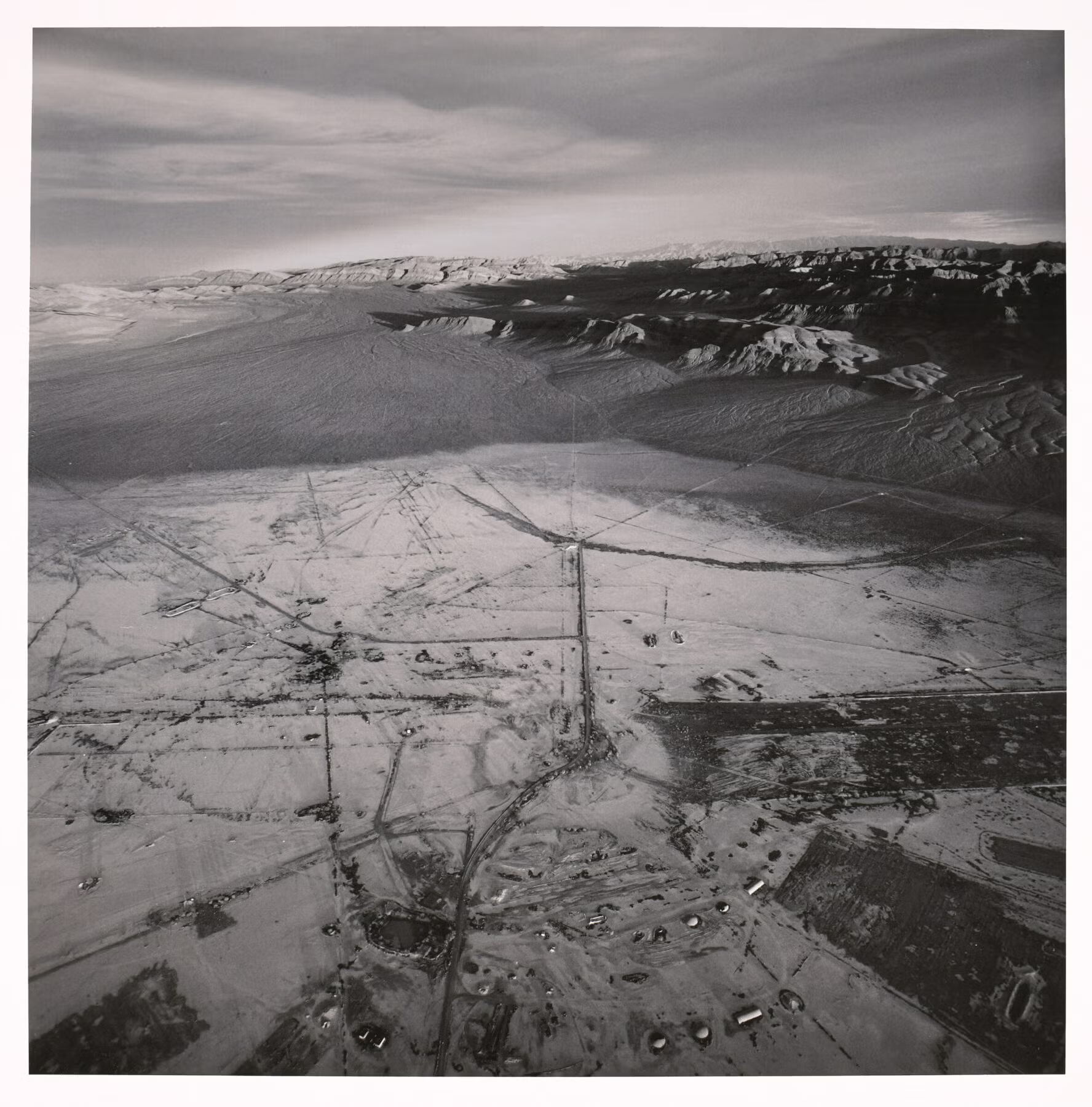
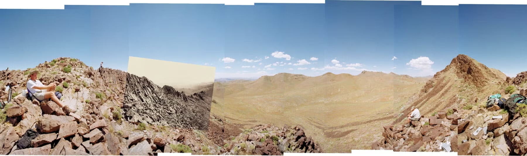
Let’s say you are proceeding up an arid valley between mountain ranges and to your left you see a small ridge several miles away that catches your attention. What was space is now already a place because it attracted your gaze. “That looks interesting,” you say. “Let’s go take a look.” Once you arrive, you find a striking rock formation and decide to take a picture. Now you’ve created a site. And so it happened on Crab’s Claw Peak just southwest of present-day Lovelock in western Nevada in 1867, a view then carefully rephotographed in 1979 on what was now Karnak Ridge, and rephotographed yet again in 1998. This sequence of duplicated vantage points was repeated in 2018 with all the attendant nested views fully in mind—which is, after all, where all sites reside.
Clarence King’s Geological Exploration of the Fortieth Parallel from 1867 to 1872 was the first of four great railroad surveys conducted in the American West. This exploration extended from Sacramento over the Sierra Nevada, across Nevada to the Ruby Mountains, and across Utah to the east side of the Rocky Mountains where the Platte River joined the Missouri. In his expedition report, King stated: “The Exploration of the Fortieth Parallel promised, first, a study and description of all the natural resources of the mountain country near the Union and Central Pacific railroads; secondly, the completion of a continuous geological section across the widest expansion of the great Cordilleran Mountain System.”
What was left unsaid was his overarching ambition to prove conclusively that the American West was not shaped by a series of great floods and earthquakes, as the catastrophist geologists had proposed, but by long, slow, continuous processes, such as erosion, as the adherents of uniformitarianism would have it. Unfortunately, both processes were invisible. Catastrophes, such as the one that supposedly carved the Grand Canyon, were purported to have happened in the inaccessible past, while erosion extended over time lines far beyond human existence. But both left evidence that could be photographed and compared.
Excerpted from the Out of Site exhibition catalog.